Project Title: Dynamic management of water storage in watersheds for reducing the magnitude of floods
Funding Agency: U.S. National Science Foundation
Period: August 2018 - July 2022
Floods have caused more loss of life and damage to property and crops than any other natural disaster in the United States. Traditional structural measures such as levees are limited in scope and effectiveness, often confined to small areas within a watershed. This project implemented a flexible and sustainable flood control strategy based on the dynamic management of water storage across wetlands. By enabling adaptive water releases hours or days ahead of rainfall, the approach maximized flood storage while preserving or enhancing wetland ecological functions. The team also developed a modular hardware/software platform to remotely operate siphons, gates, and sensors across multiple wetlands, detention ponds, and reservoirs.
The project achieved three main objectives: (1) assessed the ecological impacts of adjusting hydroperiods on wetland communities in Harris County, Houston; (2) developed modular active controls for dynamic wetland water storage; and (3) evaluated how wetland size, storage capacity, and level of control influence flood reduction at the watershed scale. Ecological constraints were incorporated to minimize adverse impacts from water level changes.
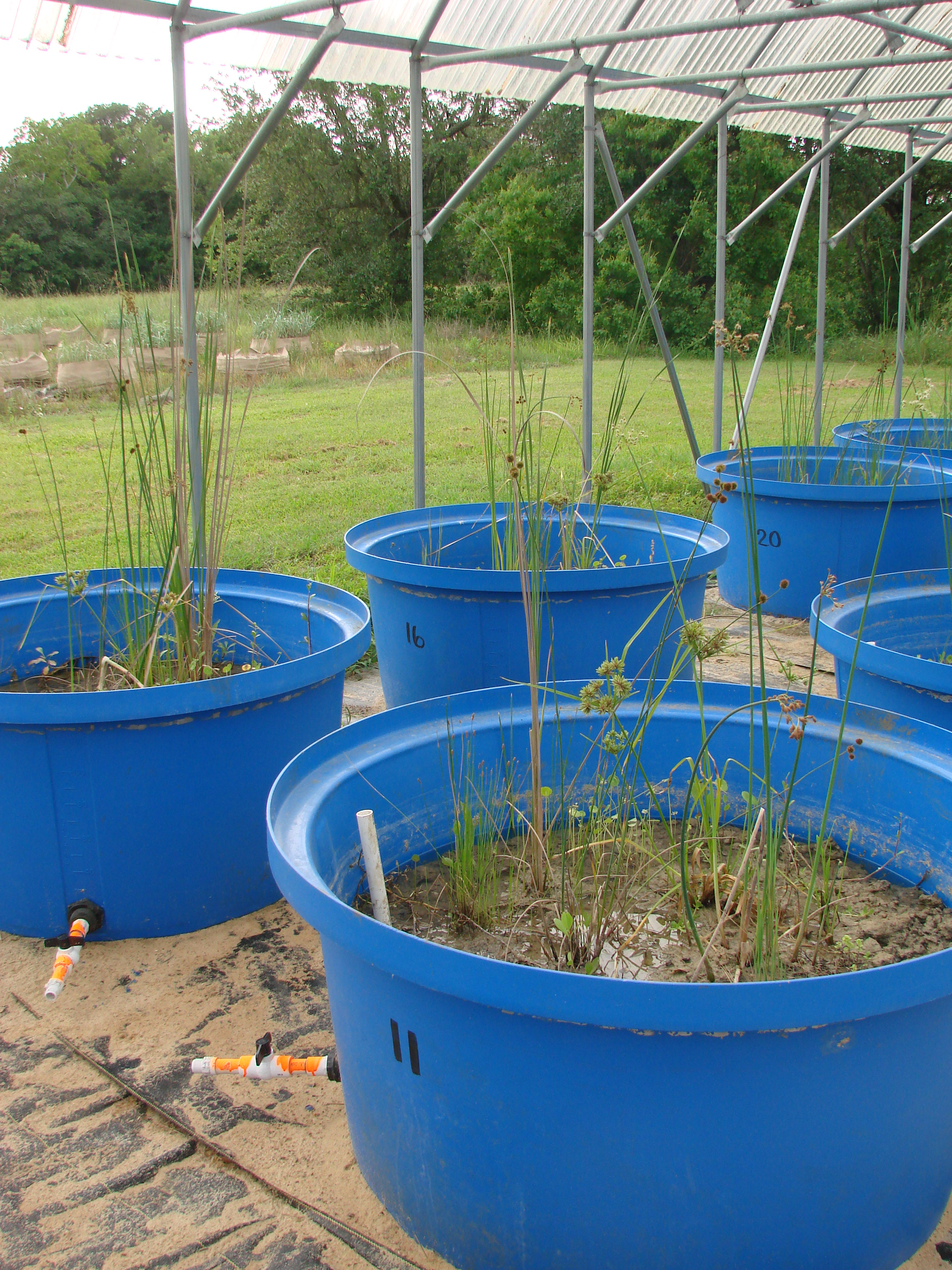
Our Mesocosms Experiments at the UHCC

Our Mesocosms Experiments at the UHCC

Our Mesocosms Experiments at the UHCC
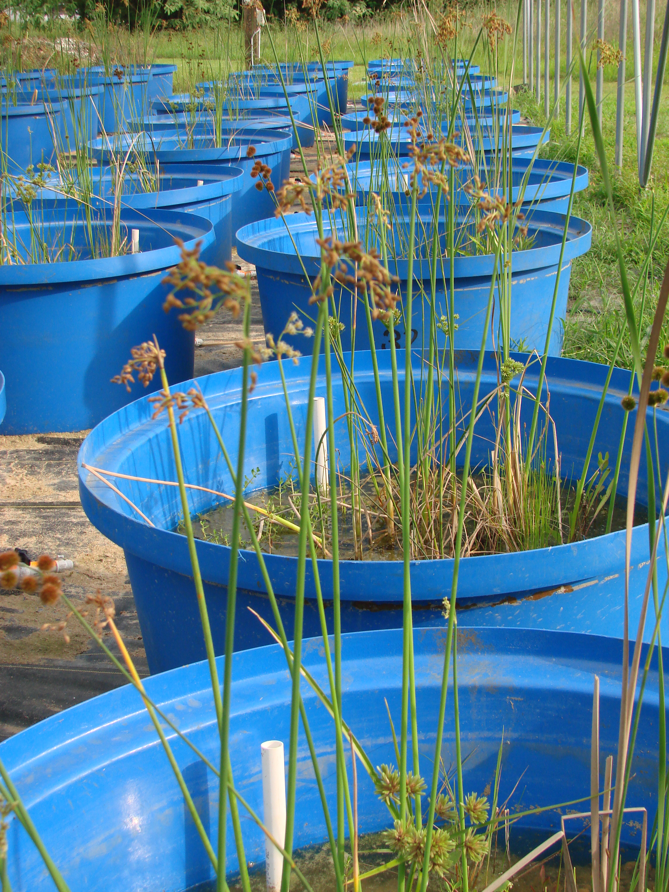
Our Mesocosms Experiments at the UHCC
Examining the impact of wetland area, volume and its location within the watershed on reducing the magnitude of floods
The team investigated how wetland size (area and storage capacity relative to the watershed) and location within the watershed affect flood magnitude at the watershed scale. Two flood-prone watersheds within the Harris County Flood Control District—the Cypress Creek Watershed and the San Jacinto–Galveston Bay Watershed—served as case studies.

Sketch of a wetland with our smart siphon system
Typical gridded precipitation used as input to our DSS
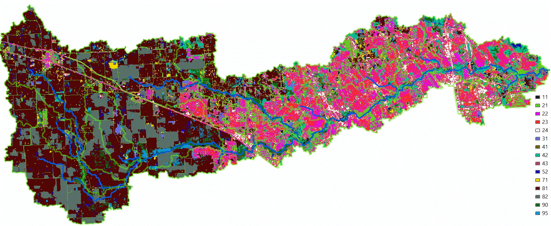
The numbers in the land cover image represent the land use class defined according to the USGS land cover institute (Case study: Cypress Creek, Texas).
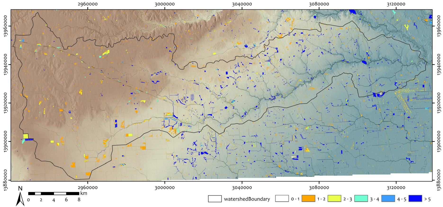
Water depths that can be sustained with existing terrain in Cypress Creek watershed, Texas
Evaluating how the size of wetlands in relation to watershed area contribute to mitigate flooding
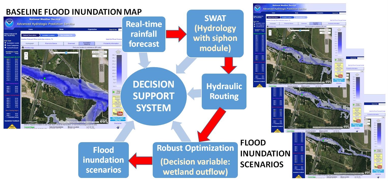
Schematic of our DSS for watershed-scale flood control
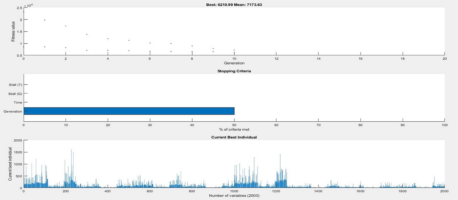
Interface of the genetic algorithm (GA) optimization for optimal flow releases from wetlands in Cypress Creek, Texas.
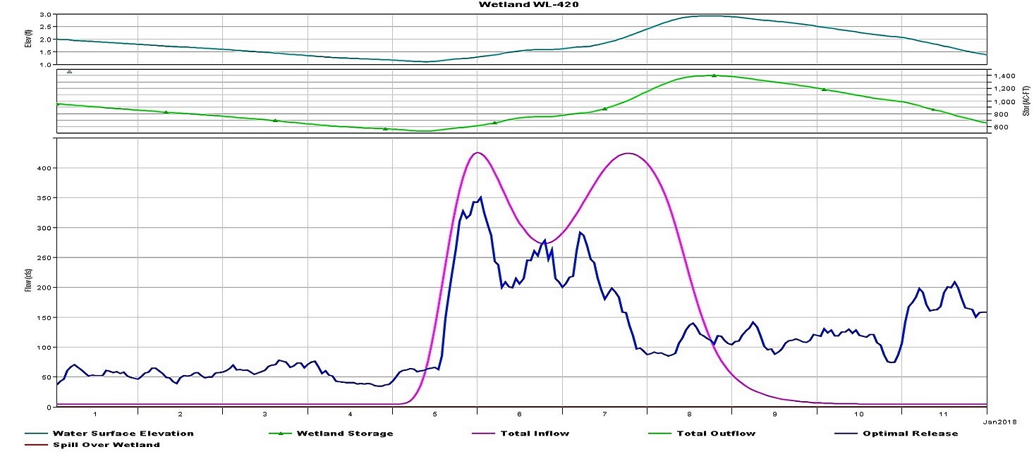
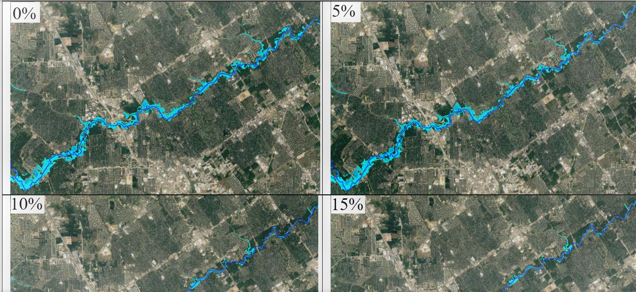
Typical result of our DSS displaying schedule of optimal water releases at wetland
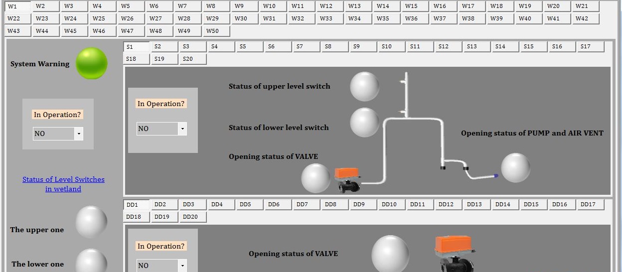
Interface of our software for the remote operation of a network of sliding gates and siphons in wetlands, detention ponds and reservoirs
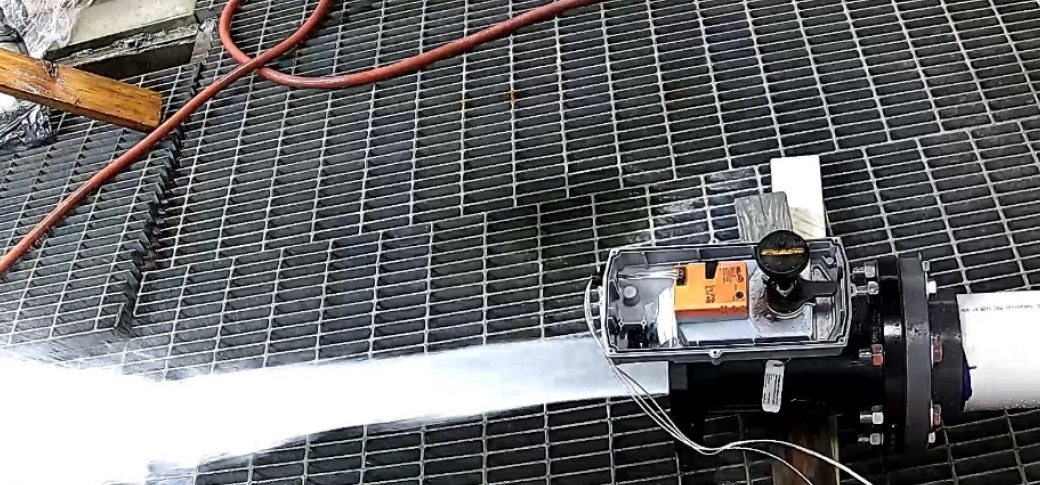
Water jet at the outlet of the actuated gate in one of our experimental tests
Towards real-time flood control
The team developed a near-real-time Decision Support System (DSS) to optimize water releases from wetlands, detention ponds, and reservoirs for flood mitigation. This system enabled adaptive releases hours or days before rainfall events, maximizing storage capacity and reducing flood risk.
To support this approach, conventional storage systems were retrofitted with remotely controlled gates and siphons. The DSS integrated hydrological modeling (HEC-HMS), inundation modeling (HEC-RAS), and genetic algorithm optimization, with automated data exchange via HEC-DSS files.
A modular hardware/software platform was also created to interface with automated siphons, gates, and sensors—allowing remote control of thousands of infrastructure points. The system primarily used 4G cellular connectivity, with options for radio, wireless, or satellite communication.
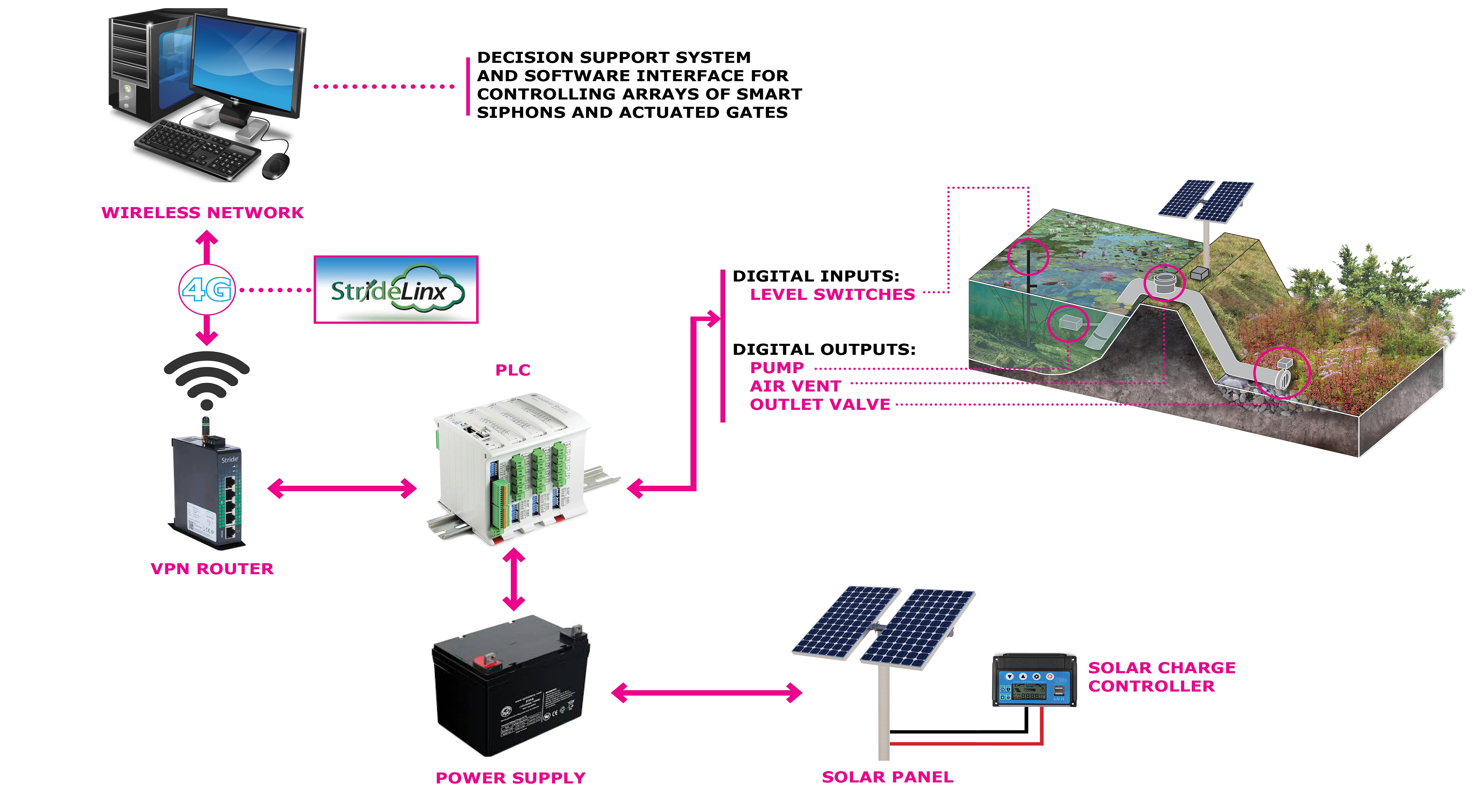
Schematic of the remote operation, communication and control of a network of storage systems for flood control

Schematic of our smart siphon system

A programming logic controller used in one of our experimental tests
COPYRIGHT, HydroOptima Solutions